
Navigating the open seas has always presented unique challenges, from unpredictable weather to hidden underwater hazards. Whether you’re a seasoned mariner or a recreational sailor, having access to nautical charts is essential for ensuring a safe and successful voyage
In this blog, we’ll explore the key benefits of using nautical charts and why they are indispensable for modern-day navigation.
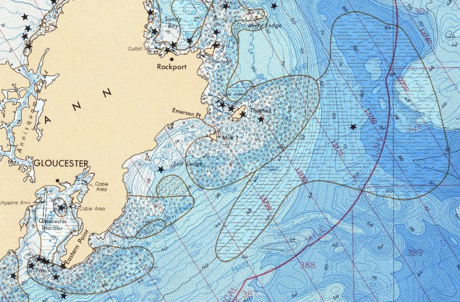
1. Accurate Representation of Marine Areas
One of the most significant benefits of using nautical charts is the accurate representation they provide of coastlines, water depths, and seabed features. Charts are designed to display crucial details such as ports, harbours, and underwater obstacles like rocks, reefs, and sandbars. This precision allows mariners to plan their routes with confidence, minimising the risk of running aground or encountering unexpected hazards.
2. Assistance with Route Planning
Proper route planning is essential for any sea journey, and nautical charts play a vital role in this process. They allow sailors to chart a course that takes into account the safest and most efficient route, helping to conserve fuel and time. By using these charts, you can identify the most navigable waters and plan around dangerous areas, saving you from detours and unnecessary risks.
3. Tidal and Current Information
Nautical charts also provide information on tides and currents, which are essential factors in determining a safe passage. Understanding how these forces affect your vessel allows you to make better decisions about when to set sail, when to dock, and how to avoid potentially hazardous situations. By having this knowledge readily available, you can time your voyage to coincide with favourable conditions, ensuring smoother and safer navigation.
4. Local Knowledge of Waters
For sailors navigating Australian waters, Australian nautical charts are an invaluable resource. These charts are specifically tailored to the unique conditions of Australia’s extensive coastline and offshore areas. With information that accounts for local tides, currents, and hazards, these charts provide detailed insights into the specific waters in which you are travelling.
5. Compliance with Safety Regulations
In many regions, including Australia, it is a legal requirement for vessels to carry updated nautical charts. Keeping your charts current ensures that your navigation practices comply with maritime safety regulations, avoiding penalties and ensuring you meet the required standards for safe seafaring.
Nautical charts are an essential tool for safe and efficient navigation, providing mariners with detailed information about marine areas, tides, and potential hazards. Whether you’re planning a long journey or just a short sail, having these charts at hand ensures a safer and more informed voyage, especially in complex waters.